Saturday, May 6, 2017

Days 46-50 - Waiting Out the Weather

Current Position: 37° 5' 49" N 76° 17' 31" W

So much happened in a short time!!

The anchorage we stayed at Tuesday night was so awesome in the evening.  If you've never watched "Rupert and the Frog Song", please do.  That will give you an idea of the symphony we listened to from our deck.  It was so calm that night that the boat hardly moved.  We never would have guessed the next night would be just the opposite!

I called the bridge in the morning.  They weren't sure if they would open or not and to call back in an hour.  Good news - it was a go! Our boat and every other boat in the vicinity headed north.  We weren't the first to go through but first in our group. With a 3 ft clearance you can see why they have problems with high water!  If you didn't read my last post - go back and read it for the prelude to this segment.


The boats quickly stacked up behind us...


This was a swing bridge, but instead of one long"arm" that swung out, it was comprised of two pieces that swung separately.  Here is the sailboat behind us going through, the left side is starting to swing closed but the right side is still open.

As one of the slower boats on the water, two of the boats behind us soon passed us up. Only the sailboat stayed behind us.  The 3rd bridge we went through was the Great Bridge Bridge (in the town of Great Bridge). It was really stacked up - we were #5 and they kept coming behind us.  Just past the bridge was our first lock.  


The dock hand grabbed our lines with a boat hook and looped them over a cleat. I wrapped my line over the "mid-cleat" (it's in the middle of the boat :) ) and Bob took the stern line.  You only loop it around the cleat once to give some leverage but the line must be able to play out as the water lowers in the lock. Because my hands were full during this time there are no pictures after we got into the lock.

More boats came behind us so the lock was nearly full.  Everything went very smoothly and we feel like pros already.  The nice part was this is supposedly one of the nicer locks, so a good one to learn on.

Shortly after we cleared the lock we entered Norfolk.  We were warned that the commercial traffic through this portion of the ICW could be very busy, but we were pleasantly surprised to find it not the case today.


First we saw the commercial side of the city - recycling center...

Not sure what was under the tarp but can you see the people climbing on top?

Next is the Naval Shipyard.  These are floating barracks that Bob thinks houses the sailors when their home (their ship) is being worked on.

 Another bridge followed by a lift railroad bridge.  The railroad bridge is up and only closes when a train comes through.  You can see the heavy counter weights on each side.

We saw ship after ship - of all kinds:

 USS Harry Truman


Mama Yacht and baby yacht

A multi-purpose ship - amphibious/air craft carrier

Three aircraft carriers in a row - they take up a LOT of room!

Container Ship

Beautiful three masted sailboat

 Research vessel?

Then there were the cranes:
 Papa crane and baby crane?

These cranes lift railroad engines.  Can you see some on the left?  The whole side of the warehouse was lined with these engines.

This crane looks like it belongs in Lego Land

And the buildings...
Not a lot of skyscrapers but this one really stood out.

 Even condos are on stilts over the water

Is this the BFG??

Portsmouth Naval Hospital

 Not sure what this is but I liked it.

Leaving Norfolk we crossed the Chesapeake Bay Bridge Tunnel.  It's half bridge, then drops down under the bay to complete the crossing.


At this point the winds and waves picked up to create an exciting crossing. It wasn't bad at first, but after 2 hours we were ready for it to be over. When I went down to the cabin I found half our belongings on the floor!  Books, coats, pillows.  Nothing damaged - just a mess.  My poor pantry was a jumble of cans and jars.

 The spray at this point was just reaching the deck.  Later we were plowing through 3-4 foot waves that splashed all the way up to the fly bridge.  Our poor boat was quite salt encrusted by the time we arrived (ever so gratefully) at our anchorage.

This is the largest "blind" we've seen.  Who owns these? This was in the river where we anchored.
  
Our night at anchor was a rocky one and neither of us got a lot of sleep.  Our anchor held well but we bounced around quite a bit.  Thursday we tried to get to our next stop at Deltaville, VA but as soon as we got out in the bay the waves were hitting us broadside and we turned around immediately to go back to anchor.  It was a very choppy day on the water and I got seasick!  AT ANCHOR!!  Crazy.  Friday we found a marina close by and agreed that being tied up to a dock would be much easier to sleep. We went to the marina in pouring down rain and were soaked to the skin by the time we got our lines tied up.  
This was our view from the cabin


It's a small marina, but inexpensive with wonderful people and nice private bathrooms (read - SHOWERS)  We originally planned to stay two nights but the weather is not cooperating yet so we may stay until Monday.  Meanwhile we got a lot of projects done - laundry (6 loads - mind you, my washer/dryer is small), defrosted refrigerator/freezer, washed the bbq grill, cleaned all the dirt off the bridge from my garden being tossed around during our heavy weather, planned the next several legs of our journey, and went shopping via Lyft.  It's the first time we've used Lyft (an Uber-like taxi).  It worked great.


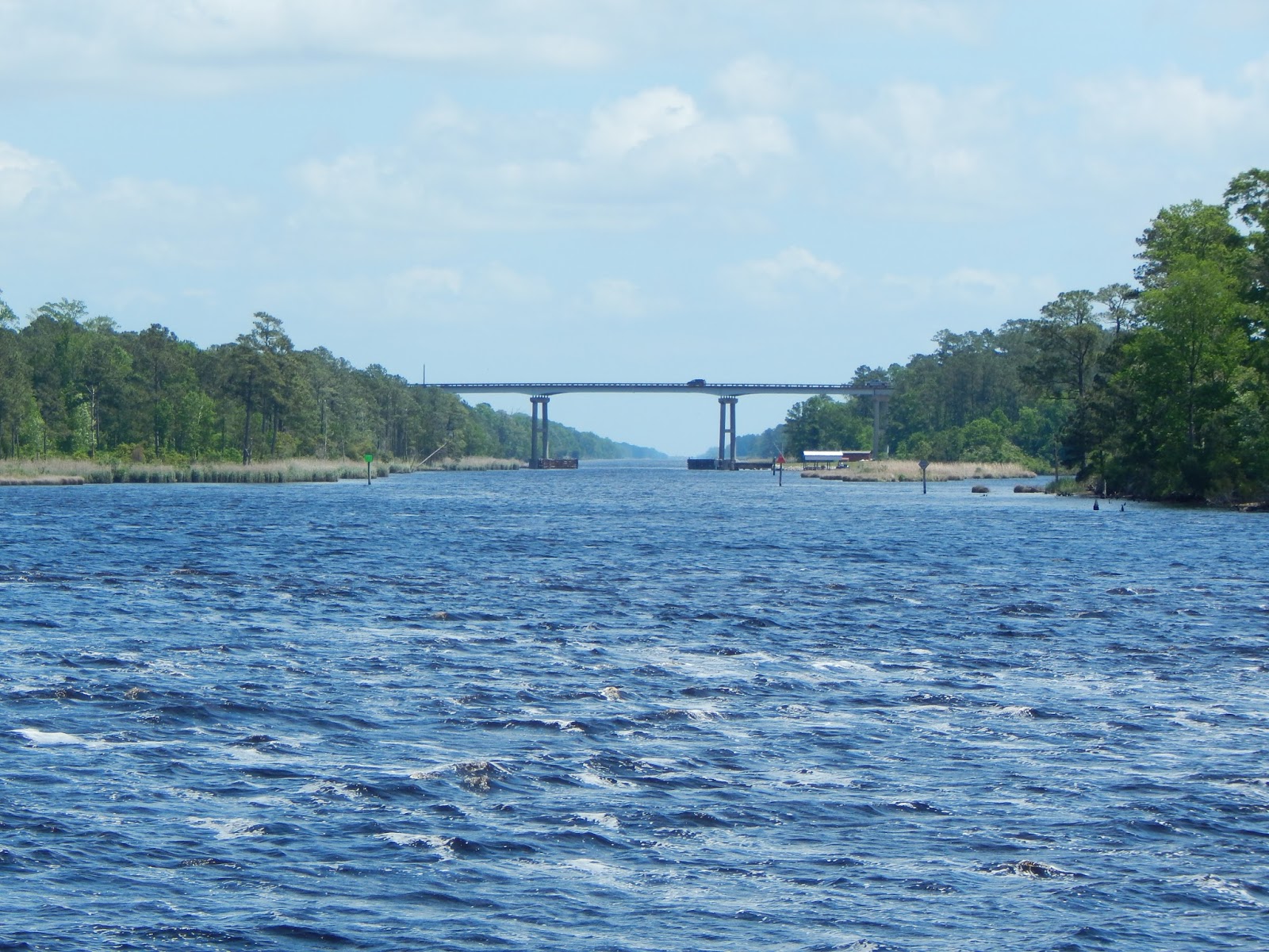
A few more pictures along the cut:

Another deadhead (stump) being towed out of the way

A beautiful re-purposing of an old bucket dredger

Anchored in Back River then docked at Belle Isle Marina

Tuesday, May 2, 2017

Day 45 - Oh well....

Current Position: 36° 36' 54" N 76° 4' 21" W

We spent a very windy night that ended with a loud thunderstorm at 5AM.  It was as though the thunderstorm said "THAT'S ENOUGH"!  As soon as the thunderstorm ended so did the wind.  We headed out at 8 hoping to be get to Great Bridge in time to dock at their free dock.  There are only 4 spaces available and lots of shopping near by.  We had a really nice transit through a cut that combined beauty of nature and a comfortable looking town called Coinjock.  It was there we began to see the flooding caused by the high winds last night.

There was a car on the road by the water when we first pulled into town.  This area is a strict "No Wake" zone.  Had we disobeyed that poor car would have been "waked" by us.  You can't get much closer to the water without being submerged.

This is all you can see of a "fixed" dock (not floating).  At least you'd have a nice foot soak!

The town is building a lovely park - notice the nice bulkhead to limit flooding!

This is Coinjock Marina - lots of Loopers stop here.  There is a popular restaurant that serves awesome Prime Rib.

After we left the "cut" we entered Coinjock Bay.  Definitely a popular place for waterfront homes...

of one kind or another!

Including the Osprey's waterfront home :)

While we were on the Bay we began to hear the Coast Guard warnings that the North Landing Bridge  was closed.  We assumed it was because of the winds as the bridges will not open in high winds.  When we really listened to the transmission, we realized they said due to flooding, so I called the bridge.  He was very kind but explained even the mechanism is under water (the bridge only has a 3 ft. clearance), and all he can suggest is to call tomorrow.  There is no other easy way around so here we wait in a nice protected river - well off the ICW (no wakes to rock and roll with).  We will call the bridge in the morning to see if our journey continues or we take an enforced rest.

Anchored in Blackwater Creek

Monday, May 1, 2017

Day 44 - Wild and Windy

Current Position: 36° 16' 7" N 75° 57' 21" W

Our day started very calm as we reviewed our route for the day.  The forecast was for winds picking up as the day progressed and our friends opted to remain at their marina.  We got underway at 6:30 this morning in order to cross the Albemarle Sound before the winds strengthened.  Success.  The Sound took us 2 hours to cross and the waves/swells were pushing us along from behind (the best direction).  As we neared the end the waves picked up to around 3 feet and made for some pretty scenery. The pictures just don't do the waves justice.  It's kind of like the dolphins - as soon as the camera comes out the waves quieted down. I should have kept the camera out all the time! There were few boats out early this morning but as the day picked up several "go fast" boats passed us.  There is a courtesy pattern to passing boats.  You radio ahead let the boat ahead know that you would like to pass and what side they would like to pass on (usually port).  Both boats then slow down so there is minimal wake.  Most of the time it works well. However, there are the few jerks that sail on past without a pause.


Notice the wake he kicks up.  This causes the boat being passed to rock violently to and fro, causing extreme discomfort to the passengers and anything not nailed down to go flying.  Occasionally you will hear a radio broadcast "Thanks for the wake".  NOT!!! 

This poor boat was "hard aground".  He was flying a Canadian flag so maybe didn't understand our navigation?  He was way outside the "channel".  As wide as the rivers and sounds are here, they are extremely shallow for the most part.  There is a dredged channel that is marked by buoys and on charts.  He had to be towed off.

We anchored early as the winds were picking up.  We are not far off the channel (far enough not to "swing" into it) and passing boats have no mercy on us.  We have been rocked violently many times this afternoon.  We are looking forward to the night as traffic will be down to a few passing barges.

This one passed us shortly after we anchored.  It looks like it's flying a sail!

In actuality it was passing a Catamaran. 

We are in for a windy night with gusts up to 44 mph.  We are anchored well so will hopefully sleep well!

Anchored at Buck Island of North River

PS - one token house:
It's hard to hold the camera steady while we're bouncing around on the waves.

This is my basil - I had a fresh basil and tomato sandwich for lunch - yum!


Day 42 -43 - The Straight and narrow

Current Position: 35° 12' 36" N 76° 35' 28" W

We left New Bern at 8:15 this morning.  Our new friends from Lakewood and our next door Looper neighbors on “Pharm Life” saw us off.  Dana on “Pharm Life” took our picture as we left the slip. 

Notice how close Bob is able to get to bulkhead while backing out of the slip - and no backup camera!  :)  He's getting good!


The morning we left was beautiful, but we knew it was only going to get hotter.  We had a nice breeze for a good portion of the morning that kept us cool.  Our big question of the day is “How in the heck do these bugs manage to fly all the way out into the middle of the river?”  Carpenter bees, wasps, horse flies, and dragon flies.  To understand this question is to understand that a "river" here looks more like Puget Sound at its widest point.  


The "sounds" here are more like inland seas.  It's a different mind set.  We are traveling the same general plan as several fellow Loopers who we plan to catch up with in Deltaville, VA on Thursday, if not before.  “Lets Go” and “Seaquest” are behind us today but ahead of us tomorrow night in marinas both nights.  “Satisfied Frog” passed us today and is anchored somewhere ahead of us.  Since we have no cell coverage, we cannot contact them.  It promises to be a nice evening.  We are anchored in a nice bay with a sailboat for company. Oops - the sailboat moved on - we are alone.


Anchored in Gale Creek off the ICW

Current Position: 35° 40' 15" N 76° 5' 27" W

A nice quiet night - we stayed in Gale Creek over a week ago on our way to New Bern.  Kind of nice to recognize something! Today was a LONGGGGG day as we traveled over 50 miles as well as stopping to fill up the fuel tanks.  We are seeing new territory now but mostly in a long narrow cut today.  

We went for over an hour in a straight line! (Bob is tightening the mousing wire on the anchor shackles.)


                           The water was very dark with tannin.  This guy passed us.  His hull is all white.

The cut was mostly wilderness with a few pockets of signs of people.

The trees here are tall and very straight

Hunting/fishing blinds are everywhere...

and look what we found along the shore without using a blind!

What looks to be a simple bridge crossing the cut...

Turns out to have an old bridge foundation beneath and...

is next to a beautiful home with two dogs playing in the water.  You just never know what lies around the next bend.

Loving our life on the water!

Anchored at Point Lookout off Alligator River