Current
Position: 46° 2' 2" N 81° 30' 24" W
Thursday
morning, we left Hopewell Bay as well as David and Kim as they waited for their
current buddy boat to catch up. Even though it was a beautiful day it was a bit
windy and we had over an hour out in the open water. It was not an comfortable ride (we’ve been in
much worse) but we were ever so happy to duck back into the protected
islands. Knowing that we have a 3 hour
jaunt through open water tomorrow, I checked the forecast and was happy to see
the winds were perfect. We would have
stopped and waited for good winds if not. The channels through the islands can
be narrow, and unforgiving rocks are your penalty for not paying attention
compared to the mud of the ICW in the states.
The scenery however, is worth the trip!
Coming
back into the islands – even if those “islands” are sheer rock.
An
inflatable playground at this house!
Point
Au Baril Lighthouse – The name derives from the days when fishermen placed a
barrel on shore with a lantern on top to guide them into the harbor. (Point of the Barrel)
An
unusual tug delivering materials to a building site.
We
don’t see many trimarans up here – too many narrow passages.
We
stopped that afternoon at a long harbor in the Bustard Islands. It was a large bay but 5 boats
were already anchored. We found a safe
spot and anchored. 2 more boats managed to find spots then a Canadian boat came
in and motored around for about 30 minutes trying to find a spot before they
finally left. I’d love to know the story
behind their name – French Toast! 2 more
boats arrived and after looking around, tied up to one of the other boats. This is called rafting. French Toast came back and rafted up with
them!
We
started with our three hour trip on the open water – nice and calm this
time. As we approached Collins Inlet,
the rocks got bigger and bigger.
The
inlet is miles long – a “God made canal” as Bob says.
And
although it is mostly quite deep in the middle – you MUST stay in the channel!
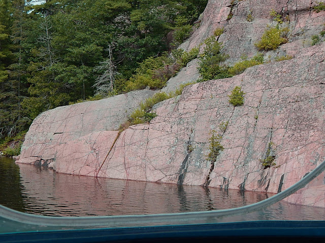
Mostly
rocky wilderness on each side in many different formations and much of that pink granite.
Someone’s
campfire ring
Even
the beavers like it here
The
fishermen do too!
Several
of these old huts are scattered around – ice fishing perhaps?
A
whole community is tucked in here!
There
was an adorable cabin tucked back in the woods that reminded me of the Seven
Dwarfs! Not sure the dwarfs owned a pontoon
boat though.
The
rock on the left is called the “Crabby Indian”. Can you see him?
As we
came out of the inlet, this canoe couple really seemed to be enjoying “The Good
Life” J
Next
on the agenda was Killarney. This is a
very popular summer village along the waterway.
Can
you see the surprise vehicle in this picture?
There
is a grocery store, a liquor store, and a fish and chips store/restaurant, all
with their own docks. We docked at the
fish and chips for lunch. A popular
place that takes 30 minutes to get your food, if you’re lucky – they lost our order so ours took
longer. It was worth the wait! I visited with a local couple while we waited
and they told us a good place to anchor for the next few nights as we waited
for the weather to improve again.
As we
left Killarney, I watched for other Looper boats as this is a favorite place to
stay. I was not disappointed, and saw
several, but only one that we knew – Mother Ocean! They were enjoying drinks on their back deck
as we shouted greetings to each other.
As we
journeyed the next 3 hours to our anchorage, the landscape lost the huge rocks
and became green lowlands.
Our
home for the next three days is in the fjord-like Baie Fine (pronounced Bay Fin). It is much larger than we expected and very
beautiful.
The
bay is 7-8 miles long with another 2 miles to a “pool”. We stopped at the end of the main bay where
our new friends at the fish and chips shop, recommended.
We’ll
dinghy into the “pool” on Monday when the weather is good.
Anchored
at the east end of Baie Fine waiting out a rainy weekend. 7/22/17


No comments:
Post a Comment