Sunday, July 30, 2017

Days 136-140 - Kagawong to St. Ignace

46° 09' 43" N  82° 37' 24" W – Beardrop Harbour
46° 04' 50" N  82° 12' 34" W – Croker Island
44° 57' 15" N  83° 17' 4" W – Robinson Bay
Drummond Island - sorry, I forgot to get the co-ordinates
45° 51' 58" N  84° 43' 7" W – St. Ignace

We left Kagawong shortly after 8 to make a quick run to Croker Island.  We knew there was a front coming in, so we didn’t plan on going far.  Good thing, because the comfort level was very low, a rough ride to say the least.  The really rough areas were short, thank goodness, and we were at our anchorage in less than 2 hours. The rain had just started as we anchored, closer to shore than we liked, but OK – we THOUGHT. It was a windy day and water was very choppy – so funny how that would have bothered me just a few months ago – now it’s just choppy water.  Bob worked on boat projects and I did some cleaning.  We played some games, read, and I made my shopping list for when we get back to the states.  We kept an eye on our position all day and we looked to be holding fine, even with the stronger winds.  The winds died down in the evening so we expected a fairly quiet night.  It was not to be.  Our anchor alarm went off around midnight, we pulled in 10 feet of our anchor chain so we weren't so close to shore and kept a watch on our position for awhile.  It appeared that we were drifting bit by bit so Bob finally started up the engines and we pulled anchor and reset it in deeper water.  This time it held well and we were able to get back to sleep.  This morning the sun was  out, no rain and NO WIND!!  Off we went to our new anchorage in Beardrop 
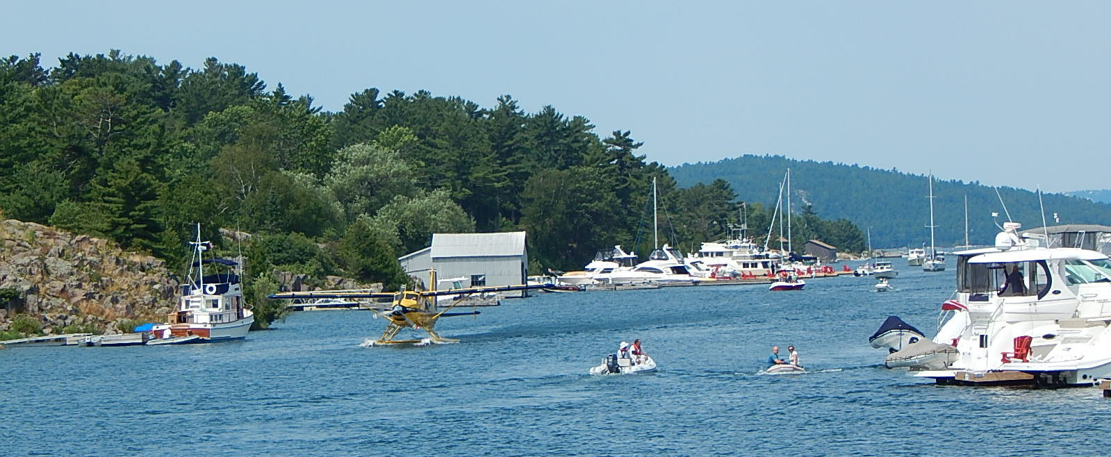
Harbour – (haven’t seen any bears yet or their droppings). It is a very popular harbor with 11 boats so far!  Lots of people dinghying to shore as we will tomorrow. We spent today re-configuring our next week as tomorrow will not be a good day to cross the North Channel.  Saturday and Sunday sound perfect.  Saturday we will cross to Drummond Island to check in with customs as we enter back into the USA and Sunday we will transit the last bit of Lake Huron to Lake Michigan! 

As for today’s journey – calm seas and blue skies!

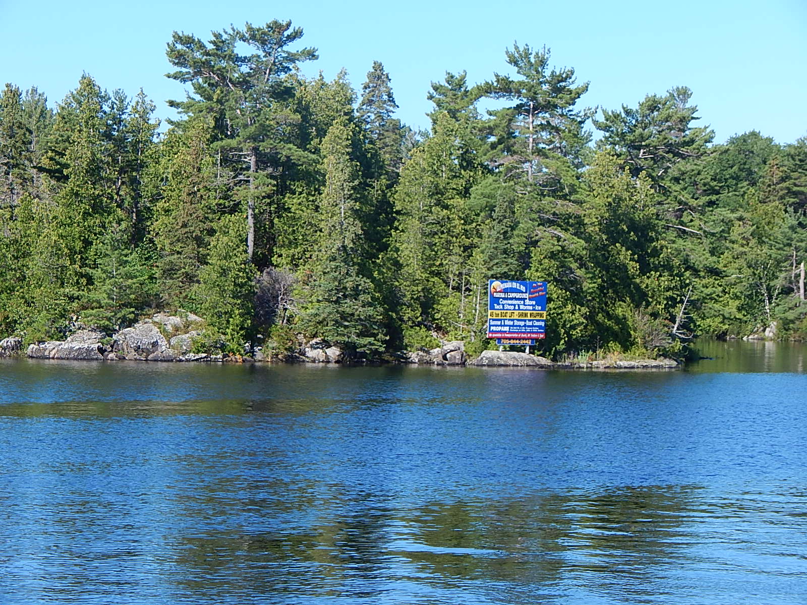
Can you say “Billboard”? On the water???


Anybody know what kind of bug this is?  They are all over our boat!

Turtle Rock

After looking at maps so much, even the clouds start looking like islands – that bay, while very protected, looks a little shallow for us J

Our home for the next two days. At least that was the plan.

Our night in Beardrop Harbor, while peaceful waters prevailed – the mosquitoes also seem to like it.  I went outside to get a picture of the gorgeous sunset...

And managed to let in about 200 hungry mosquitoes! We spent the next 5 hours hunting them down!  Every time we tried to go to sleep we’d hear the dreaded whine again!  Sleep finally came and we both slept in that morning!  Very unusual for Bob. 
In a surprise weather revision, Friday afternoon was forecast to be good traveling weather to cross the North Channel, making Saturdays trip to Drummond Island much shorter, so we decided to go ahead and cross.  It was a shame to leave our beautiful quiet anchorage but couldn’t pass up the opportunity.  The crossing was quite good, a beautiful sunny afternoon and fairly smooth water.  The anchorage on the other hand was anything but!  We were open to the swells coming off the lake.  The good news was that our anchor held beautifully despite the rocking and rolling!  Didn’t get a lot of sleep L.
Saturday was off to Drummond Island to check back into the USA.  Another smooth day of travel following two, new to us, Loopers – Chemistry and Manatee.  The marina was quite busy but managed to get us all docked and we met the new Loopers we had followed in, as well as two more!  Checking in was easy – the customs agent came right to our boat, checked our documents, asked a few questions and we were done.  We had a nice docktails on the dock with all 5 boat couples and retired to an early bed to make up for too many lost nights sleep – peaceful – no mosquitoes, no swell – just sleep!

We both woke up well rested and ready for another smooth ride to St. Ignace Marina, where we plan to spend two nights and tour Mackinac Island on Monday.  

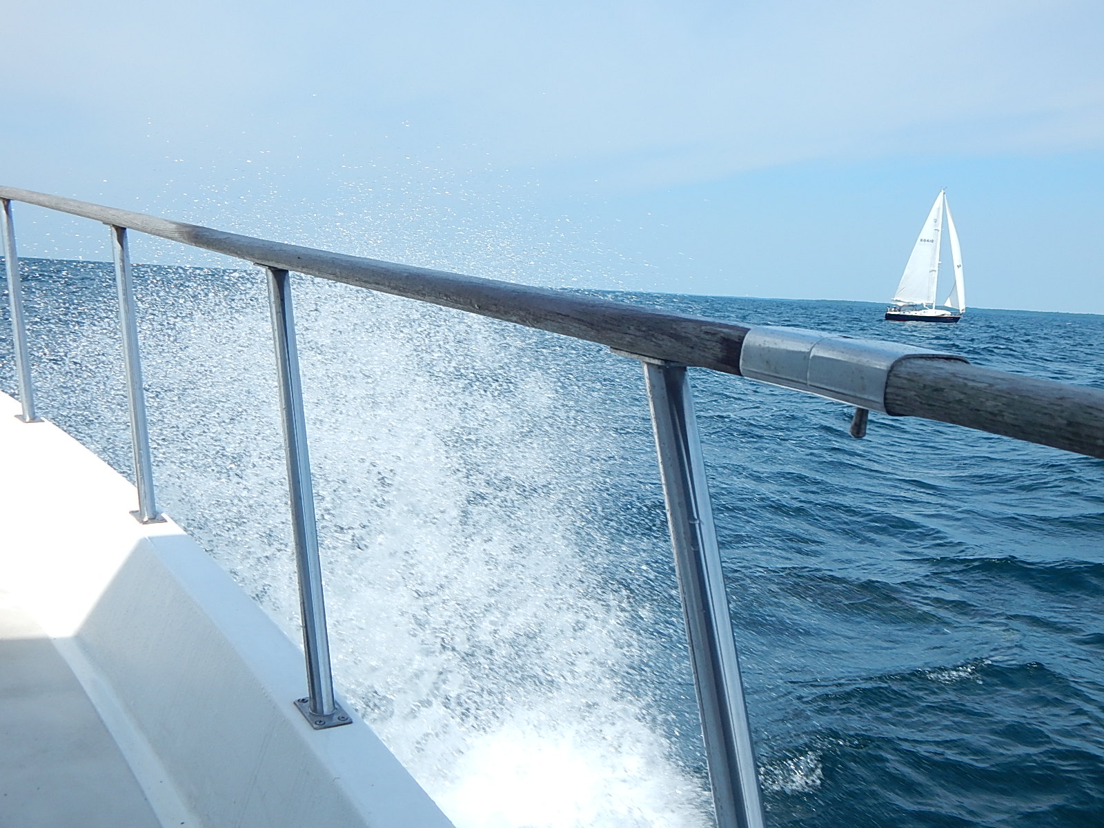
Another surprise – my wave app – which has been quite accurate so far – predicted 1 ft waves and 0 swells for today.  

This is a picture of one of these 1' waves crashing over our bow!  The sailboat, on the other hand, is flying through the water “wing and wing” – both sails out to catch the wind from behind.

Needless to say, I am spending the day down below (it's rougher up on top) and not moving about the boat unless absolutely necessary.  The crazy thing is that the app still insists we are in smooth waters!  At least it’s a beautiful sunny day and wind is coming from in front of us and not the side.  I still managed to perch on the door sill and get a few pictures.  

We saw a commercial cargo ship for the first time in two months!

A beautiful lighthouse - De Tour Reef Lighthouse - opened in 1930 and is still operating today - although now automatically.

No need to worry about depth out here!  148 feet!

Docked at St. Ignace Marina 7/30/17 - ready to tour Mackinac Island tomorrow!


Thursday, July 27, 2017

Day 135 Kagawong

45.9098° N, 82.2599° W

We left Baie Fin on a gorgeous morning, the lake was flat and the mist was spectral.


  There were so many pretty rock formations....

 ...and a waterfall on our way down the bay.

We arrived at Little Current Swing Bridge at 10:40 and had to wait with 11 other boats to wait for the bridge to open at 11.  8 more boats were waiting on the other side.  Quite a busy "Little" area.  "Little" Current is considered a misnomer as the current through here can be anything BUT little.  Today was a good day and we had no problems holding our position while we waited.

We stayed in a marina the small town of Kagawong.  It is a cute town that is trying to reinvent itself for tourists.  Several beautiful old buildings that need to be renovated.  There are some signs that this is or has been tried, but not too successful yet.  There is a "general store"/Post Office that is mostly souvenirs, but we did find a loaf of bread. The first time we went in, the owner was no where  around - although he could have been in the Post Office room.  The second time there was still no sign of him.  I called "hello" in the back room several times before he came down from his living quarters above the store.  A very personable man that chatted with us for awhile before we went back to the boat.  There is a small church next to the marina that incorporates the pieces from a boat in the furnishings!

This hangs in the back of the church - the rope on the left is the bell pull that goes right through the ceiling to the bell tower!

The gorgeous stained glass window

Can you see all the boat parts?

We then hiked to Bridal Veil Falls - 30 min. from town.  It is a very popular water hole.  With all the rain they've had the falls are very full.  Bob said the water came down very hard.  I started to go in with him but went back for the camera to take his picture instead.  I should have skipped the picture and gone swimming!  A bee found me while I was getting the camera and stung me!  I think it may be the first bee sting I've had in 40 years!  I spent the rest of the visit sitting on a rock with my hand in the cold water.  One sweet 8 year old boy got some clay for me to put on the sting!

Bob getting pounded by the falls.

One of the revitalization ideas for the area that didn't take off was a couple of mazes and a "Pine Tree Walk".  This Rock Maze is still open to the public but the Cedar maze of trees is fenced off and locked. :(  The Rock Maze is a great way to introduce children to the idea of mazes as you can look ahead to what path is a dead-end.

  A beautiful sky to say goodnight!

Docked at Kagawong Municipal Marina 7/25/17

Tuesday, July 25, 2017

Days 132-134 Baie Fine

Current Position: 46° 2' 2" N  81° 30' 24" W

We staying in Baie Fine for three nights as we knew there was bad weather ahead and this is a very protected bay.  We heard afterwards that many people in Georgian Bay and North Channel took a beating but other than buckets of rain we had very little wind.  Here is how we passed our time:

Bob took a dip in the water to cool off.  This is why it’s called a “swim step” J

He swam over to the large rock near us and had a look around.  King of the Hill!

Sunday the weather turned as expected and it rained and rained – and RAINED!


I made banana bread and worked on my blog, while Bob planned our route for the next week.  We played cribbage, gin rummy, and backgammon, as well as read to pass the time as we listened to the rain.  When Bob got up this morning, he said the dinghy was over half full of water!  We did discover a very small leak in the stateroom (our bedroom) but otherwise we are a water tight boat J.

Today has been cloudy off and on with some blue sky here and there so off we went in the dinghy, to the “pool” to explore.  We had already been waked by several boats coming and going into the channel. The boat in front is our anchored neighbor – the three in the back are coming and going from the channel.  It’s surprising how much we get rocked from their wake so far away!

Here is the two-mile-long channel from our dinghy

This lovely home's garage was at the end of the channel...

...and play area the beginning of the “pool”.

“The Pool” – It was SO much larger than we expected – room for dozens of boats.  Note the 3 in the middle rafted together.  They are a family from Michigan that comes every summer.

We pulled the dinghy up on shore and took a hike up to Lake Topaz.  The trail was mostly a stream because of all the rain we’ve had. 

The beginning of the trail was gorgeous.

It was hard to get a good picture, but the stones were marble-like in greens and pinks.

Topaz Lake was only 45 minutes up – a few steep parts but a nice hike.

Bob would have loved to go down and swim but that trail was pretty steep and I was afraid I was not in THAT good of shape.  I did offer since we had a good afternoon ahead of us and we could take it slow, but he decided it wasn’t that warm out today.  There were lots of people down enjoying the water.

We met a variety of people on the trail – most day hikers like us – but we also met a couple backpacking and:

A group of young ladies from Michigan on a two week journey!  Hats off to these young people!  That’s a lot of weight to carry! They had to carry (portage) these canoes a loonnng way!


Another couple portaging their canoe – he claimed to be immune to the mosquitoes but she was prepared!

This was the biggest surprise – a four wheeler!  I was amazed he could get up the narrow trail ahead.

Along the way, I finally found some of the blueberries we’ve been hearing about.  They are tiny but flavorful.


Back to the boat to do more laundry, boat chores, and get ready to leave in the morning.  North Channel awaits!


Anchored at the east end of Baie Fine  7/22-7/24/17

Days 130-132 Hopewell Bay to Baie Fine

Current Position: 46° 2' 2" N  81° 30' 24" W

Thursday morning, we left Hopewell Bay as well as David and Kim as they waited for their current buddy boat to catch up. Even though it was a beautiful day it was a bit windy and we had over an hour out in the open water.  It was not an comfortable ride (we’ve been in much worse) but we were ever so happy to duck back into the protected islands.  Knowing that we have a 3 hour jaunt through open water tomorrow, I checked the forecast and was happy to see the winds were perfect.  We would have stopped and waited for good winds if not. The channels through the islands can be narrow, and unforgiving rocks are your penalty for not paying attention compared to the mud of the ICW in the states.  The scenery however, is worth the trip!

Coming back into the islands – even if those “islands” are sheer rock.

An inflatable playground at this house!

Point Au Baril Lighthouse – The name derives from the days when fishermen placed a barrel on shore with a lantern on top to guide them into the harbor.  (Point of the Barrel)

An unusual tug delivering materials to a building site.

 Beautiful home on the rocks.

 This one was WAAAAY out, all by itself.  I really zoomed in to get the picture.

We don’t see many trimarans up here – too many narrow passages.

We stopped that afternoon at a long harbor in the Bustard Islands.  It was a large bay but 5 boats were already anchored.  We found a safe spot and anchored. 2 more boats managed to find spots then a Canadian boat came in and motored around for about 30 minutes trying to find a spot before they finally left.  I’d love to know the story behind their name – French Toast!  2 more boats arrived and after looking around, tied up to one of the other boats.  This is called rafting.  French Toast came back and rafted up with them!

 We had a quiet night and an early morning as we had a long day ahead of us. 

We started with our three hour trip on the open water – nice and calm this time.  As we approached Collins Inlet, the rocks got bigger and bigger.
 

The inlet is miles long – a “God made canal” as Bob says. 

And although it is mostly quite deep in the middle – you MUST stay in the channel!

Mostly rocky wilderness on each side in many different formations and much of that pink granite.


 There are pockets of civilization here and there:

Someone’s campfire ring

Even the beavers like it here

The fishermen do too!

Several of these old huts are scattered around – ice fishing perhaps?

A whole community is tucked in here!

There was an adorable cabin tucked back in the woods that reminded me of the Seven Dwarfs!  Not sure the dwarfs owned a pontoon boat though.

The rock on the left is called the “Crabby Indian”.  Can you see him?

As we came out of the inlet, this canoe couple really seemed to be enjoying “The Good Life” J

Next on the agenda was Killarney.  This is a very popular summer village along the waterway. 

Can you see the surprise vehicle in this picture?

There is a grocery store, a liquor store, and a fish and chips store/restaurant, all with their own docks.  We docked at the fish and chips for lunch.  A popular place that takes 30 minutes to get your food, if you’re lucky – they lost our order so ours took longer.  It was worth the wait!  I visited with a local couple while we waited and they told us a good place to anchor for the next few nights as we waited for the weather to improve again.

As we left Killarney, I watched for other Looper boats as this is a favorite place to stay.  I was not disappointed, and saw several, but only one that we knew – Mother Ocean!  They were enjoying drinks on their back deck as we shouted greetings to each other.

As we journeyed the next 3 hours to our anchorage, the landscape lost the huge rocks and became green lowlands.

Our home for the next three days is in the fjord-like Baie Fine (pronounced Bay Fin).  It is much larger than we expected and very beautiful.

The bay is 7-8 miles long with another 2 miles to a “pool”.  We stopped at the end of the main bay where our new friends at the fish and chips shop, recommended. 
We’ll dinghy into the “pool” on Monday when the weather is good.

Anchored at the east end of Baie Fine waiting out a rainy weekend. 7/22/17