From a calm, beautiful start to the morning, to some interesting turns.
Our anchorage this morning
We left our pretty anchorage and went under the bridge on our route north. We have a 20' foot air draft and the bridge is listed at 21'. A little close, so we called the bridge and he said 22', and the tide board read 23'. Since we just missed the opening and would have to wait for the next one, we decided to go for it. We made it with room to spare! (Not much though) :)
We quickly discovered that our chart plotter was not working. This is the instrument that shows the water ways, depth, route plan etc. Our route was there and depth directly under us but all the surrounding water, land, depth were missing or wrong. I took over steering while Bob went below to work on the problem. It's not fixed but we were able to use the computer to substitute and with both of us working together, we are able to get where we need to be safely. We'll probably have to wait until New Bern and a week and a half to talk to someone at West Marine, but will keep looking at the issue whenever we're in a town and have internet connection.
The "next bridge to cross" was another swing bridge. This one only had a 12' clearance so we had to have it opened. It only opens on the hour and we were going to be about 10 minutes too late. It's a pain to hang around a bridge waiting for it to open or finding a short term anchorage, but when you gotta do it, you gotta do it - except when there are so many boats going through the bridge stays open longer! 5 boats going north and one coming south was all it took to let us squeeze through! YAY!! Our flotilla of 6 boats stayed together for quite a distance before the speedier ones pulled ahead leaving only the sailboat in front.
It was the same sailboat we shared an anchorage with last night and low and behold, they chose the same anchorage as we did tonight! But I jumped ahead of our interesting day....
While we were following said sailboat through a very shallow area, the poor sailboat started to run aground. Luckily they were able to get off of it before they were stuck. We made sure we steered clear of THAT area. Meanwhile, another trawler came up behind us and passed us, not a wise move in such a shallow area, and promptly ran aground themselves! We went back around them and were glad to see they were able to back off the shoal. It is common courtesy to radio the boat you plan to pass, but we had received no such message before they passed us. Later, when they WERE in a safe passing area, they did hale us and apologized for the earlier pass as they had their radio on the wrong channel. They must have been frustrated when we didn't answer. So glad they got it figured out without too much difficulty.
The rest of the trip was peaceful and pretty, changing scenery again as the shoreline has more bushes and trees again, and much of the low lying islands are dry, instead of salt marsh.
It's fun seeing all the houses along the barrier islands to our right.
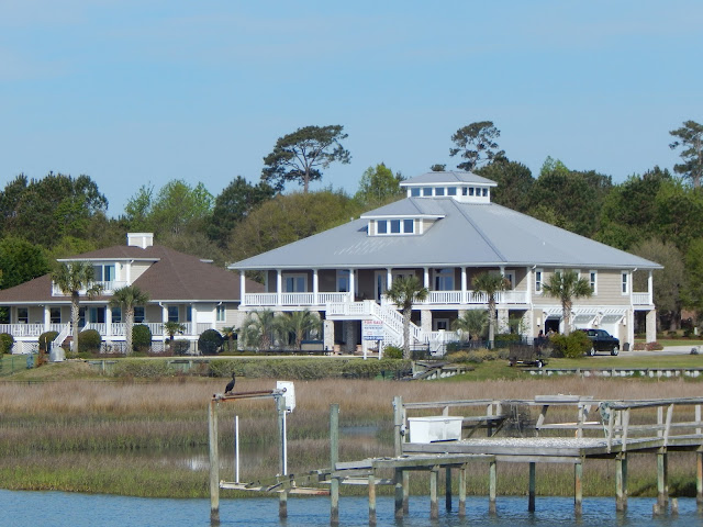
And of course there are always my favorite houses of the day:
Many on stilts:
What a statement these houses make! The big one can afford lots of waterfront but the narrow one, although a small footprint, is still on the water!
And then of course I can't leave out the birds...not so many pelicans but now we see Hawks!
Crab boats are another daily enjoyment
This is our peaceful anchorage for tonight...
Our neighbors we followed here:And our neighbors that make it not so peaceful - Camp Lejeune - jet fighters, helicopters, and V-22 Osprey. At least they should quiet down this evening. The bay we're anchored in is an area maintained by the Marines where they can do amphibious warfare related tasks (like loading amphibious ships from shore).
Anchorage at Mile Hammock Bay - Camp Lejeune.


No comments:
Post a Comment